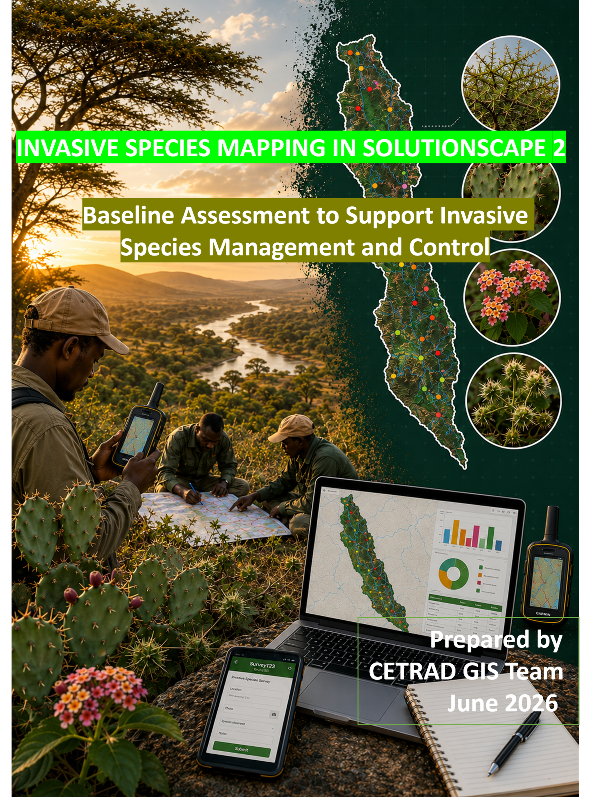

Along the seasonal rivers of northern Kenya, change often arrives quietly.
A thorny shrub appears where livestock once drank. A wetland edge becomes harder to cross. Grasslands that once fed herds give way to unfamiliar plants carried downstream by seasonal floods. Year after year, these changes spread almost unnoticed—until the landscape begins to function differently.
In these drylands, rivers connect everything. They sustain people, livestock, wildlife and wetlands. Increasingly, they are also helping invasive plant species move across the landscape.
Across Kenya’s arid and semi-arid lands, invasive plant species are becoming one of the fastest-growing threats to healthy rangelands. They compete with native vegetation, reduce pasture, restrict access to water, alter wildlife habitat, and increase the cost of managing already fragile ecosystems. For communities whose livelihoods depend on productive landscapes, the consequences extend well beyond ecology—they affect food security, household incomes and resilience to climate change.
Yet one of the greatest challenges is surprisingly simple: you cannot manage what you cannot see.
Understanding where invasive species occur, how they spread, and which places are most vulnerable is essential if restoration efforts are to succeed.
That challenge brought together communities, scientists and conservation practitioners across Solutionscape 2, a landscape spanning parts of Isiolo and Meru counties, where people and wildlife depend on the same interconnected rivers, grazing lands and wetlands. Together, they set out to create something that had never existed before: a community-informed picture of invasive species across the landscape, built by combining local knowledge with modern geospatial science.
The first experts are those who live with the landscape
Long before satellites pass overhead or maps are produced, local communities observe change.
Pastoralists know where grazing has declined. Farmers know which weeds return after every rainy season. Elders remember rivers that once flowed differently and landscapes that supported a richer diversity of native vegetation. Their knowledge is cumulative, grounded in decades of living with the land.
Rather than beginning behind computer screens, the project began around printed satellite maps.
Community representatives, local administrators, natural resource managers and technical specialists gathered during a participatory mapping workshop to identify places where invasive plants had become part of everyday life. Participants traced river corridors, marked grazing areas, highlighted farms, roads and settlements, and discussed how different invasive species were expanding across the landscape. Their collective understanding became the blueprint for the next phase of the work.
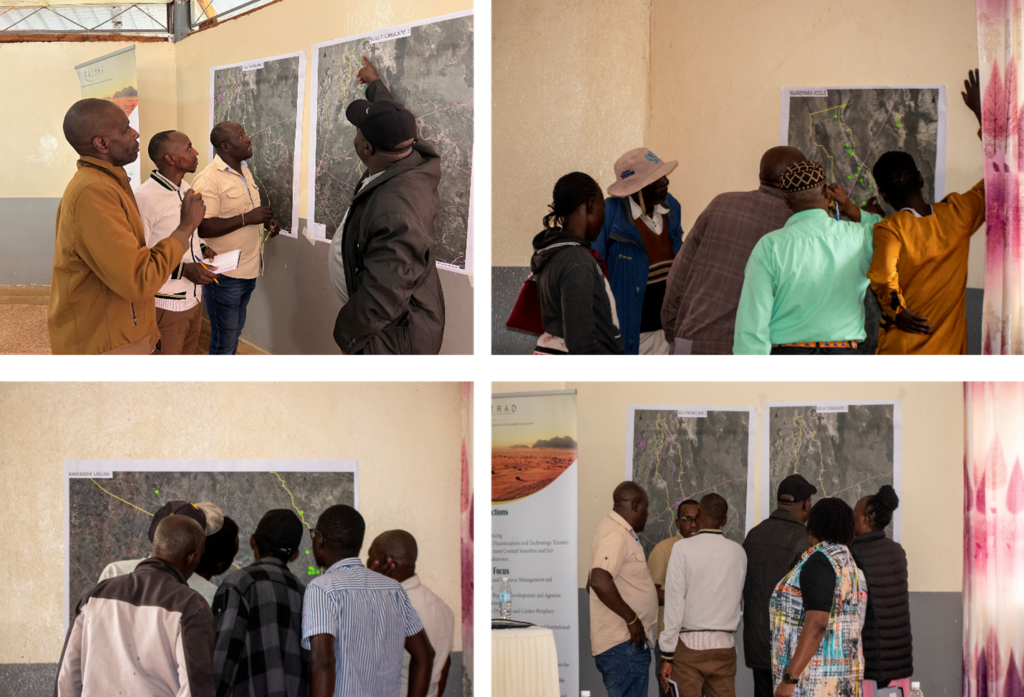 Photo by: Beverline Nyatichi
For many participants, the workshop represented more than an opportunity to produce maps. It was a chance to connect individual experiences into a shared understanding of the landscape.
“Before this exercise, we knew where the invasive plants were, but we had never seen the whole picture. Now we understand that what is happening on one farm is connected to what is happening along the river and across the landscape. That gives us hope that we can work together to manage it.” — Community member, Gambella
In conservation, local knowledge is sometimes treated as something to validate with science.
Here, it became the science’s starting point.
Walking the landscape
Maps drawn in workshops only tell part of the story.
Over the following months, the CETRAD GIS team returned to the landscape alongside local resource persons who had helped create those maps. Guided by community knowledge, they visited rivers, wetlands, farms and grazing lands to verify infestations and record their locations using mobile geospatial tools.
Working along river corridors, floodplains and transport routes, the teams confirmed hundreds of invasive plant locations across the landscape. These field observations were then combined with satellite imagery and geospatial analysis to produce the first community-informed maps of invasive plant distribution across Solutionscape 2.
The result was far more than a map.
It was a new understanding of how invasive plants move through a connected landscape.
Invasive plants follow opportunity
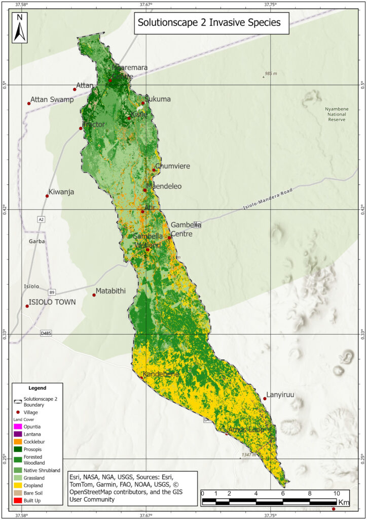
The resulting maps revealed that invasive species are not scattered randomly across the landscape.
They follow pathways.
Seasonal rivers transport seeds downstream. Roads create disturbed ground where invasive plants establish more easily. Farms and settlements become stepping stones that allow species to spread into surrounding ecosystems.
Among the species recorded, Prosopis juliflora – known locally as Mathenge – emerged as the dominant invader. Dense stands were concentrated around Ngaremara and extended along river systems and transport corridors, illustrating how water movement and human activity combine to accelerate its expansion.
Across the mapped landscape, Prosopis had already invaded approximately 755 hectares, making it by far the most widespread invasive species identified during the study.
Cocklebur (Xanthium strumarium) followed a different pattern. It flourished in wetlands, floodplains and cultivated fields around Gambella, Atir and Maendeleo, where seasonal flooding and disturbed soils created ideal growing conditions. The species occupied an estimated 568 hectares, posing a growing challenge for farmers and wetland ecosystems alike.
Other invasive plants, including Lantana and Opuntia, remained more localized but highlighted another important driver of invasion: people themselves. Often introduced intentionally as ornamental plants or living fences, these species have gradually spread beyond their original purpose into neighbouring habitats.
The maps confirmed what many community members had long observed: rivers that sustain livelihoods are also becoming the pathways through which invasive plants spread.
Protecting those rivers therefore becomes central to protecting the landscape itself.
Seeing the landscape differently
The value of mapping extends beyond producing attractive maps.
For county governments, conservancies and restoration practitioners, spatial information transforms decision-making.
Instead of attempting to remove invasive plants everywhere, managers can focus resources where intervention is likely to have the greatest long-term impact: along river corridors before seeds disperse downstream, beside transport routes that facilitate new invasions, or within wetlands whose ecological importance far exceeds their size.
As one of the GIS Analysts at CETRAD explains:
“Maps don’t remove invasive species, but they help us decide where action will have the greatest impact. By combining community knowledge with field observations and satellite data, we’re giving landscape managers the evidence they need to prioritise restoration instead of reacting after invasions have already spread.”
The mapping also creates something equally valuable—a baseline.
Future surveys will be able to measure whether restoration efforts are reducing invasion, whether new hotspots are emerging, and how changing rainfall patterns influence the movement of invasive plants across the landscape.
In a changing climate, the ability to measure change is becoming just as important as responding to it.
Conservation begins with collaboration
Across Africa’s drylands, invasive species management has too often focused on removing plants after they have become firmly established.
Solutionscape 2 demonstrates a different approach.
By bringing together community knowledge, field observations, Earth observation data and geospatial analysis, the project shifts attention from reacting to invasions towards understanding them. The result is not only a richer picture of where invasive plants occur, but also why they occur and where future action should begin.
The findings point to clear priorities: controlling Prosopis juliflora and Cocklebur in heavily invaded areas, strengthening monitoring along rivers and roads, restoring degraded sites with appropriate indigenous vegetation, and continuing to involve communities as active partners in surveillance and landscape stewardship.
The work also demonstrates that conservation is strongest when local knowledge and scientific evidence reinforce one another. Communities know where change begins. Geospatial analysis reveals how that change spreads across the wider landscape. Together, they provide the confidence needed to make better decisions.
Mapping possibilities, not just problems
Healthy landscapes are never defined solely by the challenges they face.
They are defined by the choices people make in response.
Across Solutionscape 2, communities have shown that the knowledge needed to protect rangelands already exists within the landscape itself. When combined with satellite technology, participatory mapping and geospatial science, that knowledge becomes something even more powerful: evidence that can guide restoration, strengthen local decision-making and improve the resilience of ecosystems shared by people and wildlife.
The maps produced through this initiative do more than show where invasive plants are today.
They reveal where restoration can begin tomorrow.
In a landscape where rivers connect farms, grazing lands, wetlands and wildlife habitat, every intervention upstream has the potential to shape what happens downstream. By understanding how invasive plants move through these connected systems, communities and conservation practitioners can act before today’s isolated infestations become tomorrow’s landscape-wide problem.
Because the future of northern Kenya’s rangelands will not be determined by invasive species alone.
It will be determined by how early people choose to act—and by the shared knowledge that helps guide those choices.